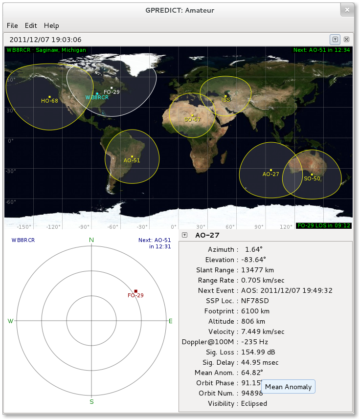
gpredict is an application to show the locations of various satellites. Satellite locations and ground footprints are shown on a map, a polar display showing the user's sky view of the spacecraft is available, and another window shows various details of the orbit. The displays are updated in real time.
Before using
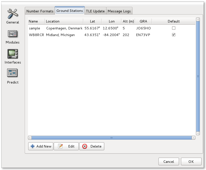
gpredict, the user should select from the menu and set up station location and display name. (Refer to
Figure 58, “Select Ground Station”.)
First, select the
Ground Stations tab and click
Add New.
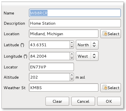
A dialog will pop up (
Figure 59, “Ground Station Settings”) which will permit entering the station details. Note that by clicking the
Select button, the location may be chosen from a list.
When complete, be sure to check that the desired station is selected as the
Default so it will be displayed on the map (the right column in
Figure 58, “Select Ground Station”).
Next, the user should update orbital parameters by selecting from the menu. Downloading these values may take a few moments.
By default, a few amateur satellites are shown. The lower portion of the display will show details for the spacecraft currently in view. Orbital parameters for another satellite may be selected from the dropdown to the left of the satellite name.
There are a number of other displays available, and additional groups of satellites may be configured which may be shown in tabs ( -> ). Clicking on the small downward triangle to the right of the window (
Figure 60, “Module Menu”) brings up a menu which permits editing an existing module.
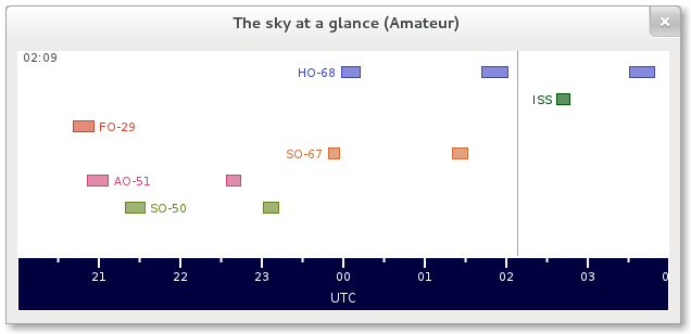
Also available from that module menu is a
Sky at a glance selection which brings up
Figure 61, “Sky at a glance”, showing which spacecraft in the module will come into view within the next eight hours.
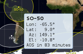
In the map view, hovering over a spacecraft will display the current position information: